
Tillamook Burn 20M
May 9, 2025
20 Miler
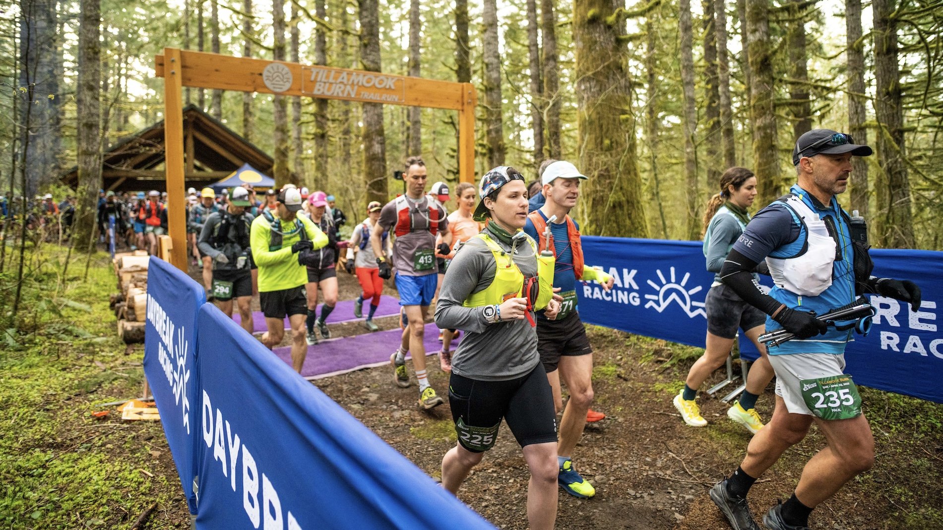
The Tillamook Burn 20 Miler is a super fun, tough out-and-back course, run entirely on the renowned Gales Creek Trail. The route takes runners from historic Reehers Camp to Gales Creek Campground and back, involving 20.8 miles, 3800 ft. of ascent and 3800 ft. of descent. There are 3 aid stations along the course.
The trails are quite hilly with a generally soft dirt surface offering great footing, although there are some technical sections with rocks and roots, as well as some long climbs and descents. Runners will cross many small rushing streams, pass by multiple waterfalls, enjoy miles and miles of remote creekside trail and some nice territorial views.
Race Day Schedule
RACE DATE: Friday, May 9, 2025
START/FINISH: Reehers Camp in Tillamook State Forest
CHECK-IN: 8:00-8:45AM
START TIME: 9:00AM
#1 CUT OFF: 12:00PM at Gales Creek Aid Station (mile 10.4)
#2 CUT OFF: 2:30PM at Bell Aid Station (mile 17.2)
FINAL CUT OFF: 3:30PM at Reehers Camp (6.5 hours to finish).
BONFIRE: ALL DAY!
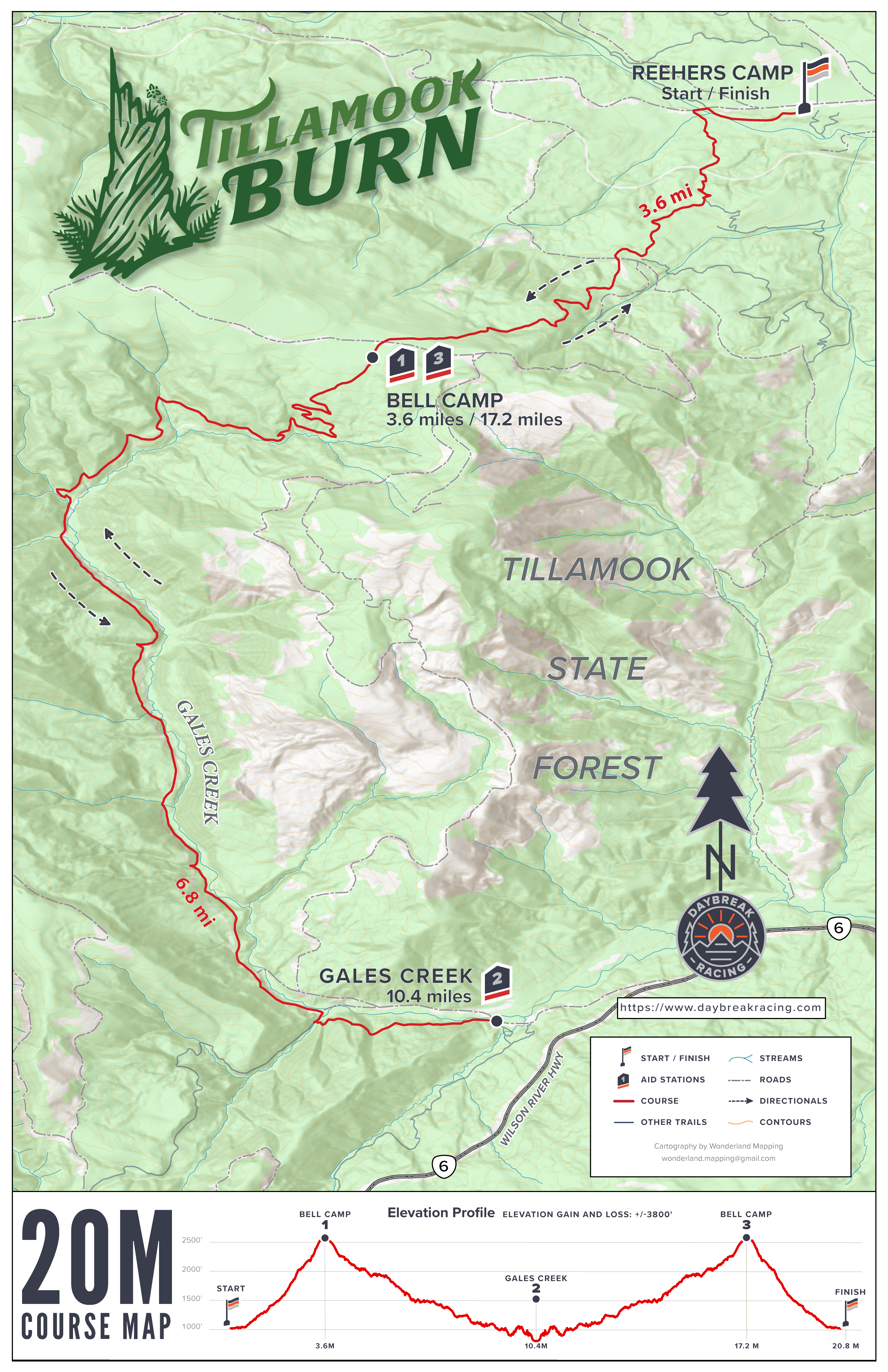
Course Map & Profile
MAP: Click on the course map image to open a high resolution copy.
INTERACTIVE MAP: Click HERE for an interactive course map in Caltopo.
GPX DATA: Click HERE for a .gpx data file of the course.
ELEVATION CHANGE: The course has 3800’ of ascent and 3800’ of descent.
Aid Stations
The 20 Miler has three aid stations. Bell Camp #1 is self-service with Neversecond gels and hydration drink only. Gales Creek #2 and Bell Camp #3 are full service and well supported with enthusiastic and experienced volunteers. Be sure to express your appreciation for their support during the race. The aid stations will also have medical personnel present with a full compliment of emergency response and first aid equipment.
All Daybreak races are CUPLESS. Be sure to bring your own drinking vessel/cup for liquids such as soda at aid stations.
All aid stations will be well stocked with: Neversecond gels and hydration drink, water, soda, PB&J sandwiches, cookies, various fresh fruit options, potato chips, gummi snacks, a variety of other ultra fare and basic first aid supplies.
| Aid Station | Total Distance (mi) | Miles to Next Aid | Restroom | Cutoff |
|---|---|---|---|---|
| Start | 0 | 3.6 | Yes | -- |
| Bell Camp (self serve hydration only) | 3.6 | 6.8 | No | -- |
| Gales Creek | 10.4 | 6.8 | Yes | 12:00PM |
| Bell Camp (2) | 17.2 | 3.6 | No | 2:30PM |
| Finish | 20.8 | -- | Yes | 3:30PM |

Course Detail
Start to Aid Station 1 (Bell Camp): Runners depart Reehers Camp on Gales Creek Trail, cross the Nehalem River bridge then begin climbing some small rolling hills for the first 1.5 miles. This is followed by a rowdy 1450' climb in the next 2 miles up to Bell Camp Trailhead and Aid Station 1.
Aid Station 1 (Bell Camp) to Aid Station 2 (Gales Creek): Runners depart Bell Camp on Gales Creek Trail and get a long, rolling descent for 6 miles on scenic creekside trail, crossing many small streams. At the junction with Storey Burn Trail, runners veer left over a footbridge to remain on Gales Creek Trail for .8 of a mile to Gales Creek Trailhead for Aid Station 2.
From Gales Creek, runners return the way they came, passing back through Bell Camp Aid Station for Aid Station 3 on the way back to Reehers Camp for the finish.

Crew
Your crew and spectators are allowed at the start and finish area at Reehers Camp, and at Gales Creek Aid Station, but not at Bell Camp or anywhere else along the course.
Driving directions to Gales Creek Aid Station from Reehers Camp (45 minutes drive time):
Google Map link: https://goo.gl/maps/sDaCsHDH4j8Ch3LWA
Travel east on Cochran Rd for 2 miles to Timber
Turn RIGHT on Timber Road for 6.6 miles to Hwy 6
Turn RIGHT onto Hwy 6 for 3.7 miles
Turn RIGHT onto Gales Creek Campground entrance road for 1 mile.
PARK in available day use parking lot areas at Gales Creek day use. Do not cross the road bridge into the campground even if the gate is open. Logging operations may close and lock the gate at any time.
Drop Bags
None for the 20 miler.
Pacers
The event permit does not allow pacers.
Trekking Poles
Trekking poles are allowed.
Weather
Check the latest local weather here.
Cancellations
See the Daybreak Racing Cancellation Policy.
This event is located entirely on the Tillamook State Forest, managed by the Oregon Department of Forestry. In accordance with State and Federal law and Oregon Department of Forestry (ODF) policy, this institution is prohibited from discriminating on the basis of race, color, national origin, sex, age or disability. ODF is an equal opportunity provider and employer.